




Quick prototypes & scale-up
Your algorithms
=
+
Satellite imagery


1 - From a few validated sites → operational coverage over hundreds to millions of km² and long archives.
2 - From per-scene grids → one fixed grid, resampled once per-pixel time series stay stable.
3 - From scripts → your models as versioned chain stages (Python, R, Jupyter, Docker).
2 - From per-scene grids → one fixed grid, resampled once per-pixel time series stay stable.
3 - From scripts → your models as versioned chain stages (Python, R, Jupyter, Docker).
What you get out of Geovio
Explore
Flood Maps in Slovakia
Burned Area Detection in Catalonia
Flood mapping over Slovakia with ICEYE SAR, delivered through Geovio.
Read the case →
Read the case →
Flood Maps from Space
A step-by-step guide for managing geospatial data in the Geovio platform.
Read manual →
Read manual →
Base Workflow
This Jupyter notebook demonstrates a complete workflow for cloud detection.
Read how to →
Read how to →
Cloud Detection
Free account
Get in contact,
we support the
application for funding.
we support the
application for funding.
Research,
educational or
pre-commercial?
educational or
pre-commercial?
Not credit card required
0,00 €
- 1 Project
- 5 Users
- Cloud deployment
- Support: human by email
- Unlimited compute
- 1 runner
- 20K API requests
- 2GB NetworkTraffic
- 20GB Storage
Your own AOI over open Copernicus data, Sentinel at no processing cost.
Notebook workspace and dashboards included.
Notebook workspace and dashboards included.
Free today, ready for growth
- Compute linear in AOI count, quoted in advance.
- Your models and containers as chain stages.
- Commercial fusion (Planet, Airbus, ICEYE, SatVu).
- Co-developed operational chains for organizations.
When your method goes to production
Frequently asked questions
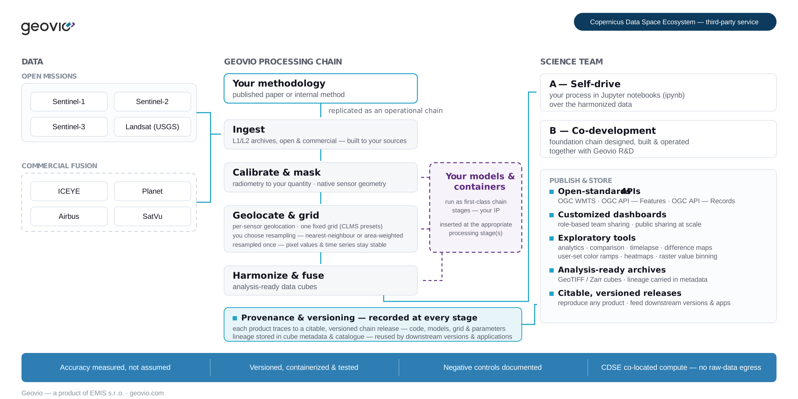
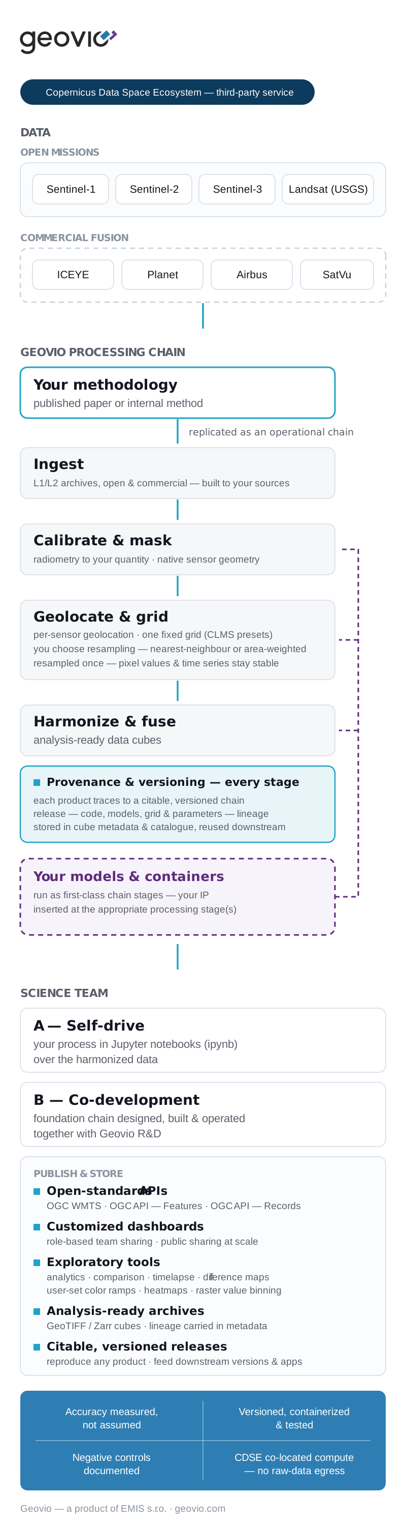
Ready-made products embed processing decisions made for other domains, and the quantity a method requires is often not in any catalogue. Starting at L1 keeps radiometry, masking, geolocation and gridding under your method's control — one fixed grid, resampled once, so per-pixel time series stay stable.
Yes — your models and containers (Python, R, Jupyter, Docker) run under the same provenance and versioning as the rest of the chain.
You do. Team algorithms and models remain your contractually protected IP — they run inside the chain without leaving your ownership.
A workspace with your own AOI over open Copernicus data, Sentinel at no processing cost, with notebook analysis capability and dashboards
- Unlimited compute
- 1 runner
- 20K API requests
- 2GB NetworkTraffic
- 20GB Storage
- 1 Project
- 5 Users
- Cloud deployment
- Support: human by email
Your processing time slows down. You will be prompt to upgrade.
Open standards throughout: OGC WMTS, OGC API — Features and OGC API — Records, GeoTIFF/Zarr cubes with lineage, dashboards with role-based and public sharing — and you can download your data at any point or have results delivered into your own environment.
Negative controls are documented, pipelines are containerized and tested, and every product traces to a citable, versioned chain release.
Geovio is the infrastructure to source, fuse, process, visualize and share large Earth observation datasets on the cloud; running models close to the data, with no heavy local downloads.
Geovio, a product of EMIS s.r.o.
Geovio, a product of EMIS s.r.o.